The Invisible Line in the Garden: Auditing Drainage Before an Extension
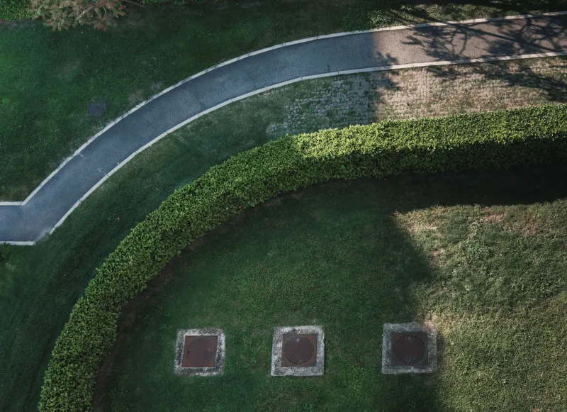
At the early design stage, a rear extension is usually discussed in terms of light, access and planning policy. The constraint that most often changes the drawing is underground. A public sewer or private drain may cross the garden, and the easement around it may cut through the proposed footprint. By the time the water company raises an objection, the design fees have been spent. The drainage easement walk exists to prevent that sequence.
The record is a hypothesis; the garden is the evidence
Water company sewer maps, title plans and local authority records are the starting point. They are not a substitute for inspection. Maps are indicative, adoption records can lag, and private drains are often absent. A 2026 pre-extension survey should compare the record with what is visible: covers, rodding eyes, air admittance valves and the line of the drain as it leaves the building. The surveyor is looking for the point where the paper record and the physical evidence agree, and for the points where they do not.
Public sewer or private drain?
The distinction matters legally and practically. A public sewer is normally adopted by the water company; a private drain serves a single property, while a lateral drain may run beyond the boundary. Build-over consent is usually required where a proposed building will sit over or close to a public sewer. The exact trigger depends on the company and the deed, so the surveyor should record what is there and let the designer and solicitor apply the rules. Do not assume that a cover in the lawn is private because it serves only one house.
The walk: a measurable sequence
A repeatable drainage walk is more useful than a collection of photographs. Number every cover and record its location by measured offset from the house and boundaries. Note the cover level, the invert level, the pipe diameter, the direction of flow and the material where visible. Photograph the cover, the chamber and the surrounding ground. Use safe lifting equipment and do not enter confined spaces; where internal condition matters, arrange a CCTV survey rather than improvising.
The output should be a plan at a suitable scale, with the drainage line superimposed on the proposed extension footprint. Mark the easement or build-over zone as a measured band, not a pencilled approximation. The designer can then see whether the extension clears it, clips it or sits directly over it. A simple table of manholes is also valuable: reference, cover level, invert level, depth, diameter, direction and notes.
Invert levels in plain terms
The invert is the lowest point inside the pipe at a manhole. The difference between cover level and invert level gives the depth of the drain. The difference between two invert levels over a measured distance gives the fall. These figures matter because foundations, ground beams and drainage diversion all depend on them. A drain at 1.2 metres depth and a drain at 2.4 metres depth present different risks to an extension, even if they look identical from the lawn.
Easements and build-over zones
Easement widths are governed by the deed and the water company's requirements, not by a universal rule of thumb. Many companies seek a clear zone of about three metres either side of a public sewer, but the adoption agreement and current guidance take precedence. The survey should therefore record the source of the zone and mark it clearly. If the proposed extension intrudes, the options include redesign, diversion or an engineering solution acceptable to the company. Those are design decisions; the surveyor's job is to make the constraint measurable.
Working with the solicitor and the designer
The drainage walk should feed two other processes. For the solicitor, it provides evidence for enquiries about drains, sewers and easements. For the designer, it provides a constraint plan before the layout is fixed. In practice, the most useful moment for the walk is after the measured building survey but before the planning drawings are finalised. At that stage, the extension can still move a metre to the left without undoing the scheme.
What the pack should contain
A useful drainage pack includes a measured plan, a manhole schedule, levels, photographs, copies of the records relied upon and a short limitations statement. It should state the date of inspection and identify any covers that could not be lifted. For a 2026 transaction or planning application, that pack is more persuasive than a paragraph saying that drains were not inspected.
When the drawing should move
If the drain crosses the proposed footprint, the cheapest moment to change the design is before the planning application, not after the builder arrives. A measured drainage walk is a modest cost against the risk of a stalled extension. The garden may look empty, but the line beneath it is part of the property. Measure it before the spade turns.